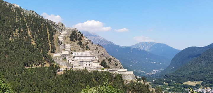
The history of ancient Exilles (the Excingomagus of the Celts and Exmilia of the Romans) is less linked to that of the fortress of the same name than one might think. From ancient times military works garrisoned by a central authority (the Roman emperors first, the Dolphins, the King of France, and finally the King of Sardinia) were raised in the area, but the fortress garrisons were also recruited from distant countries that had nothing in common with the local inhabitants.
The fortress almost always functioned as a logistical base for controlling the borders of Piedmont and France, and in case of raids, the village was the first to bear the consequences. In this regard, we recall the June 1453 massacre by Duke Lodovico of Savoy, who sacked the village, slaughtering the inhabitants. Then there were numerous raids by the Waldensians between 1560 and 1574, and in 1650 the village was burned and sacked by a band of deserters and cavalry soldiers.
On the other hand, during the Middle Ages and up to the 17th and 18th centuries, looting actions against border towns were frequent without any way for fortress garrisons to intervene. This explains why the town of Exilles, which had such an important fortress behind it, had its own fortifications and a shelter to house inhabitants and supplies during sieges, thus separating its military history from that of the fort.

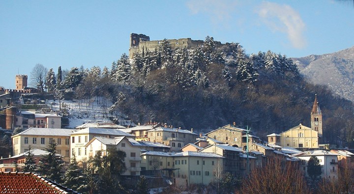
The village of Exilles seen from above (Federico Milesi).
The settlement was and still is constituted1 by a quadrilateral bounded by the four main streets of the village. The built-up area has gradually developed over the centuries from a medieval ricetto with a classic square shape that is still clearly recognizable within the village's building fabric.
Inside this building complex one could only penetrate through doors, called "Côr" (in patois andito, covered passage), one in the center of the side towards Susa, one in the center of the side towards the Dora, one in the center of the side towards Oulx, and two towards the mountain. The houses that rise along the sides of the quadrilateral all have a particular characteristic: they are cellars and their floors are 70 centimeters lower than the ground floor; in addition, there are lintels of passages that were probably communicating.
There were no buildings inside the shelter, and the open space served as shelter for the herds in case of aggression and siege. The village was divided, in an east-west direction, into three zones: Corlote, Charrière and Chaclà.
Corlote was the interior of the central quadrilateral, while Charrière was the ancient street of France (now Rome Street) at the end of which, upstream and downstream, two bottlenecks are visible, traces of the ancient gates that closed its entrances. The buildings facing this road form a series of small ricetti flanking each other. Seven can still be counted, and the oldest is the one in St. Anthony's alley in the Borg du Crin (tradition says there was a stronghold inside that served as a hospital for the Antonians, who famously cured ergotism and shingles with pork lard). An original statuette is still visible here alongside a recent painting of naive artistic quality.
In the center of the Charrière still runs a ditch, fed by water from the Galambra stream, then called the "Biarje," similar to that of the Grande Garguille in Briançon and probably serving the same functions during fires.
ALSO READ: “Bienvenue à Briançon”: un tour nella città fortificata più alta d'Europa
THE PARISH CHURCH OF SAINT PETER
At the south end of Charrière, on a narrow esplanade, is the present parish church, which dates from the 15th century and is dedicated to St. Peter. This church stands on an early Christian basilica, probably dedicated to Mary: evidence of this is the capitals visible half a meter high on the first two pillars of the nave, which attest to the existence of columns below.
The facade, with the entrance portal surmounted by pointed arches, ends with a cornice of hanging arches. Characteristic Dauphiné heraldic signs and fleurs-de-lys of France are visible to the right of the portal. The high altar dates from 1682, and a carved wooden tabernacle is preserved in the right aisle, from which, according to tradition, the monstrance with the consecrated host was removed during the sacking of 1453.

Exilles, St. Peter Parish Church, Retable of the High Altar.
Legend has it that the loot was loaded onto a mule and transported to Turin where the animal knelt down and would not go any further. The pyx opened and the consecrated host rose: this was the miracle of the Blessed Sacrament, in memory of which the Corpus Christi church, designed by Ascanio Vittozzi, was built.
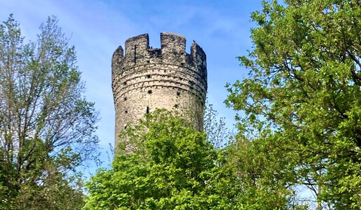
The Chaclà, called "Chatellard" in more recent documents, is the southern part of the village and was the fortified gateway under the cliff. The houses rising around it still bear visible traces of the ancient military function: towers, patrol paths and loopholes. The only remaining example of this line of fortifications, besides the walkway in Vicolo della Torre, is the stone tower that remains elevated in Vicolo San Giovanni. Perhaps the top of the cliff had housed a Celtic "oppidum," a military base and observation post for the warriors of the Cottian king Donno, who had taken refuge in the mountains to escape the Romans.
THE CHAPEL OF SAINT ROCH AND SAINT SEBASTIAN
The southern part, downstream of the village, took the name "Catra Vià" and reached the road junction to which the ancient Celtic road headed, which on the orographic left slope climbed from Susa via Maddalena and reached Cels. The ancient route mentioned by Ammianus Marcellinus in the 15th book of the Histories probably connected to this road junction and reached the Ambin pass.

The chapel in a postcard from 1929 (Private archive of the Reymond family).
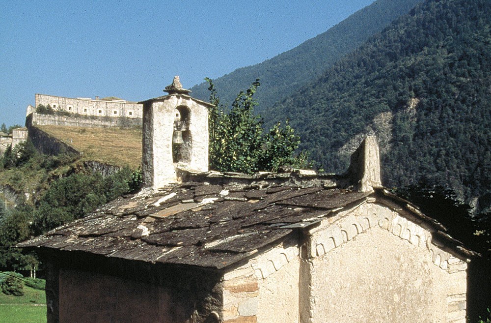
Here stands the chapel dedicated to Saints Roch and Sebastian, one of the last chapels in the area still privately owned, which, next to a secondary altar, holds a statue that E. Patria attributes to St. Anthony.
The small church was commissioned by Pierre Odiard, Consul of Exilles, in 1660.
The confraternity of white penitents, in ancient dialect called the Batu, was one of the last great penitential movements to occur in Europe throughout the Middle Ages. They were present in Exilles, where they were assigned the north altar of the main church dedicated to St. Sebastian, their patron saint.
When the small church was dedicated to St. Roch and St. Sebastian, the Batu left the altar in the north aisle of the main church and gathered in the new sacred building, until some disagreements with Pierre Odiard led them back to the main church.
It preserves a sandstone lintel with three carved crosses and some early Christian sculptures on the northwest corner: human figure pierced by arrows, probably St. Sebastian, bow and arrow, javelin, and horse.

These bas-reliefs may have come from the grounds of the ancient cemetery that Peter Capoul bought and donated for the construction of the chapel in 1658, or they may have been present in situ: during excavations on the west side conducted to constitute the walkway behind the building, skeletons were resurrected in the lime, burial reserved for plague victims. This leads one to think that there was an older cult building present that after the plague of 1600 was reorganized and dedicated to Saints Roch and Sebastian2.
Early Christian sculptures lent themselves to various interpretations, which Marco Cibonfa's detailed study summarizes as follows:
-
North: cycle on St. Sebastian, Christian family and splayed arch window with Lily of France, Dolphins of Vienne and winged angel.
-
South: St. Roch, cycle on St. Peter.
-
West: early Christian symbols that may be even older (shell).
-
East: main facade with Golgotha, date of construction, name of the developer-owner (Pierre Odiard) and other early Christian symbols at the base (fish, circles)

The only signs that cannot be interpreted are the missing ones that were stolen in the postwar years: missing are the early Christian plinths that stood in the five-foot-square frame on the northwest side complementing the crucifixion of St. Peter and a bas-relief dedicated to St. Roch that was inserted in the aedicule (now walled up) on the south side
However, the presence of the building testifies to an active associational life when one considers that in the 1600s Exilles had as many as four religious confraternities (Confraternity of the Holy Spirit, of the Rosary, of the Penitents, and of the Blessed Sacrament, all devoted to religious and charitable purposes), which had so much impact during such conflicting periods as religious strife and set an example of a small democracy within a central ecclesiastical power.
1 Ettore Patria, "News about an ancient Roman-medieval village: Exilles," in "Segusium" June 1971, year VIII.
2 On this aspect (damnatio memoriae, the reinterpretation of pagan and Christian cult buildings over time) see Marco Cibonfa, "The Chapel of Exilles Dedicated to Saints Rocco and Sebastian," in Segusium.
We thank Marco Cibonfa for advice and clarification.


